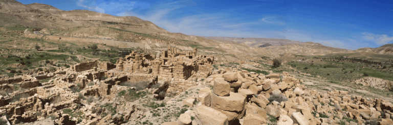
Shâ‘ara
Support provided by sponsorship from Total and its subsidiary Total E&P Syria made it possible, starting in 2000, to study a complete village in southern Syria, Shâ‘ra, located in the northwest corner of the Laja, the ancient Trachonitis.
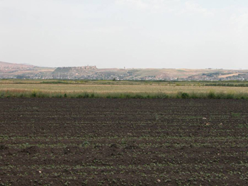
This area of recent lava flows with chaotic landscapes, difficult to access, was at the beginning of the 1st century BC a refuge for populations living off banditry at the expense of caravans coming from Arabia to supply the markets of Damascus.
A village shaped by its defensive role
The repression of this banditry was entrusted in 82 BC to the Nabatean king Aretas III, and finally by Augustus to Herod the Great. Military colonies (Bathyra, Sour) were established for this purpose near this desert enclave located within a vast agricultural territory.
The defensive and control functions marked the village of Shâ‘ra, which, placed on the edge of the volcanic flow, overlooked the agricultural plateau to the west, but could at the same time monitor the interior of the Lejâ.
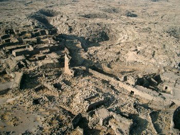
The integration of the village into this context and its defensive structures constituted the first focus of our program. The most visible is a practically continuous rampart, a rare feature in a village of southern Syria, but of limited thickness (less than 1.50 m), which indicates that it was not built against an organized army, but rather against bands of raiders. It was dated through surveys to the course of the 2nd century CE.
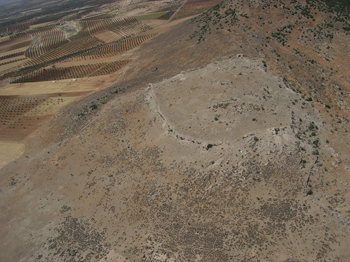
Before the 2nd century, defense could have been ensured by houses built on the tops of hills overlooking the village, and perhaps also by a square-planned fortress dominating the Leja to the east of the village. The rampart could mark a phase of territorial expansion of the settlement. Some insecurity persisted, or returned, around the 4th–5th centuries CE.
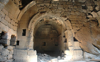
The houses of the village of Shâ’ra
The village space of Shâ‘ra seems to have been formed by the growth of several initially separate clusters of dwellings. This evolution, characteristic of a type of housing in the Near East, did not lead here to dense housing. All built structures were inventoried and studied by P. Clauss-Balty.
In a large number of houses, a module can be identified consisting of a hall with an arch flanked by smaller rooms distributed over two levels. This design, related to the strength of the basalt beams in the roofs, is not found in neighboring geographical areas. The side rooms were often used as stables with granaries above for fodder, but some houses also have living quarters on the upper level.
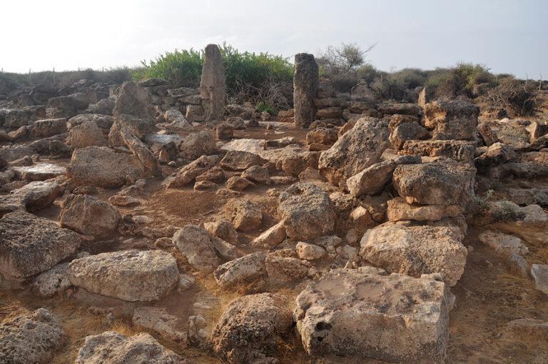
Excavations or surveys were carried out on four houses. The oldest archaeological material (Persian or Hellenistic) remains out of context. The construction phases range from the 1st to the 3rd century, and then to the 4th–5th centuries. Later states after this period could be traced accurately up to the medieval period and then the modern period. The overall plan of the houses was not fundamentally altered until the last occupations, which date from the early 20th century.
Bibliography
- CLAUSS-BALTY P. (éd.) 2008. L’habitat dans les campagnes de Syrie du Sud de l’âge du Bronze au XVe siècle, actes de la Table-ronde tenue à l’université de Paris 7 – D. Diderot en avril 2005, Bibliothèque archéologique et historique de l’IFPO, BAH 181. Contributions de F. Braemer, P. Clauss-Balty, J. Dentzer-Feydy, J.-M. Dentzer, J.-P. Vallat et J. Leblanc, F. Villeneuve.
Participants
- Jean-Marie Dentzer† (member of the Academy, Professor Emeritus Paris I)
- Pascale Clauss-Balty (associate researcher))
- François Renel (Inrap), Jean Bruant (Inrap)